
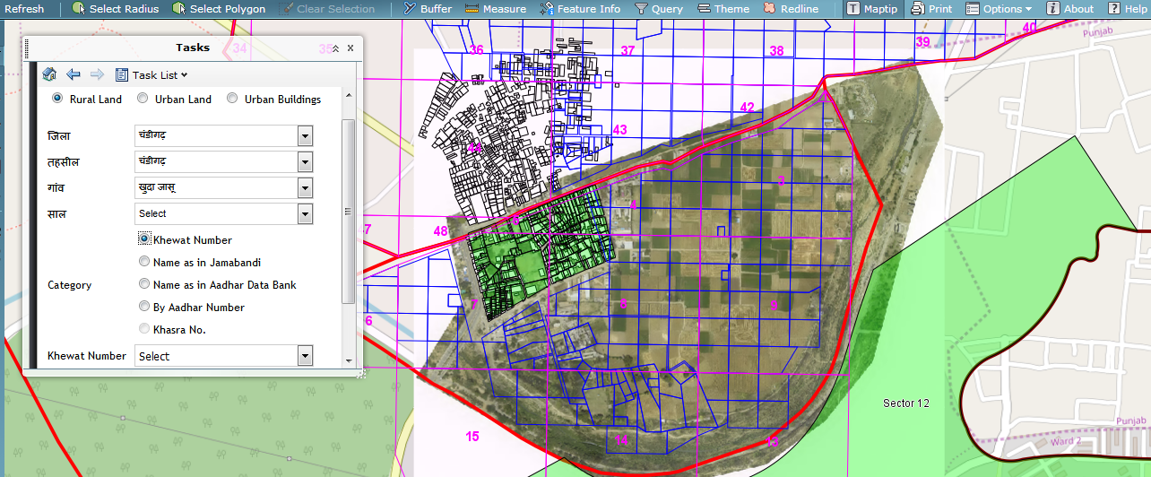
Rural Land | ||
 |
 |
 |
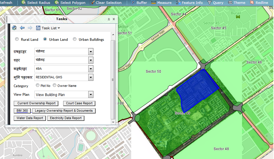
Urban Building | ||
 |
 |
 |
PROJECT OBJECTIVES:
- To store Property Titles (Land-Rural Areas, Buildings, Plots-Urban Areas) registered with Sub Registrar Offices in Secure Database and Block Chain to prevent unauthorized tampering of Titles
- To provide a facility to Citizens to search, download Property Title Report along with Property Sketch online
- To Trace Title History displaying Sub-Divisions, Amalgamations of Land
- To mark the properties under dispute by integrating Land Title System with Court Information System so that Citizens are alerted about properties in dispute
- To mark the properties under lien by integrating Land Title System with Bank Information System so that Citizens are alerted about properties under mortgage
THE CHALLENGE:
Land Title Records are maintained by Departments such as Revenue, Municipality, Sub Registrar Office, which often have IT Systems which are not integrated, resulting in a situation, where Government is not in a position to comprehensively certify the ownership, extent of property to rightful owners.
Land Title Records also face the following issues:
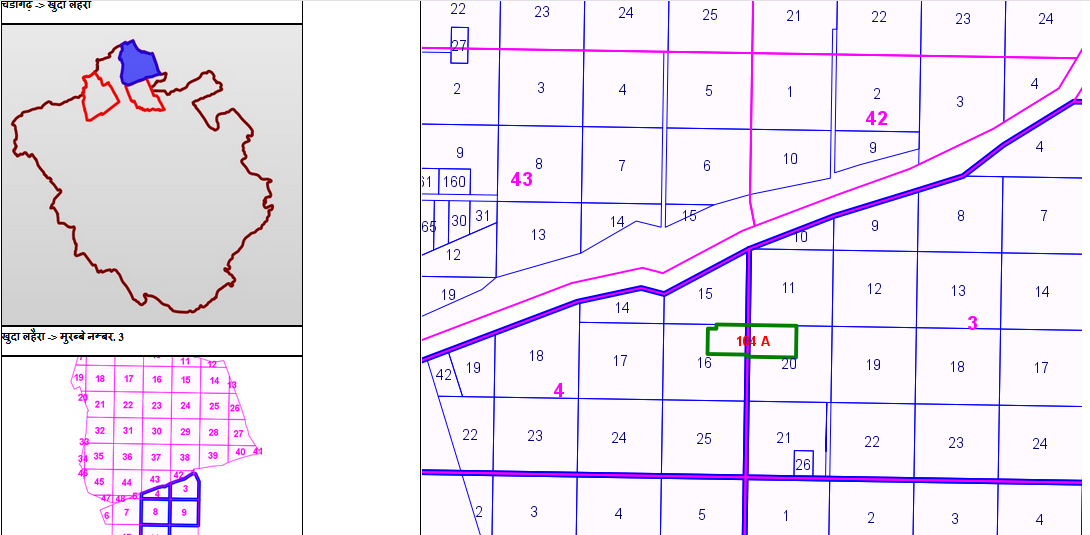
- Cadastral Maps
- Not Updated
- Tattered
- Blue Prints or Paper
- At most scanned and digitized individually as DWG Files
- No Centralized GIS System
- Lack of Standards for creation and updation of Maps
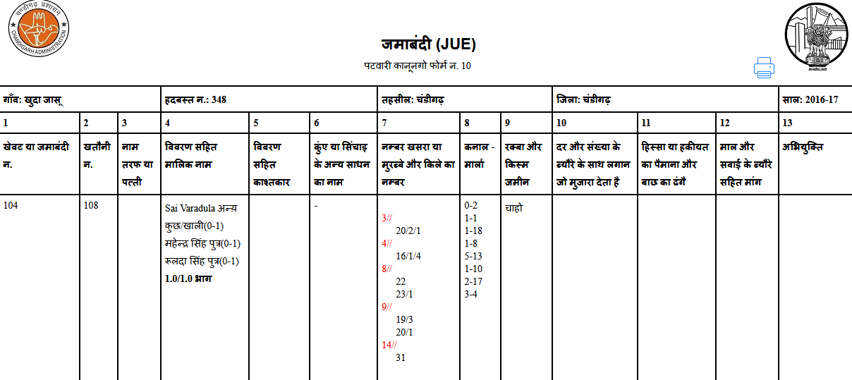
- Title Documents
- Tattered
- Paper, PDFs
- Location and Extents mentioned in Title Documents do not match those on ground as Title Documents are registered without field survey
- Same Land registered to multiple owners illegally
- Some Title Documents are tampered leading to legitimate owners running behind courts to prove their title
- Lack of Integration of Title Information between Revenue, Municipality, Courts, Banks, Sub Registrar Offices
- No Single Source of Truth and each Department claims their version of Title is correct
- Lack of update of Cadastral Maps, each time land title is changed, showing different owners in Pattadar Passbooks and Title Deeds
- No Standard Process Flows for recording, maintaining Title Information and sharing of the same between different Departments creating huge red tape
THE SOLUTION:
| Step# | Description | Method |
|---|---|---|
| Step 1 | Collect Point Cloud Data and Take Ortho Images | Aerial Survey |
| Step 2 | Digitize Point Cloud Data to Geo-Referenced Drawing | Lidar Processing, Map Digitization |
| Step 3 | Create GIS Maps with Standardized Layers and store data in Spatial Databases | GIS Data Model, GIS Stylization, GIS Publication |
| Step 4 | Reconcile Title Data in Paper Format, Scanned PDFs, Databases and Attach Title Attributes to Spatial Entities | Updated GIS Parcel Data with Title Attributes |
| Step 5 | Scan and Store Legacy Titles in Cloud | Encrypted Storage of Titles on Cloud |
| Step 6 | Collect Disputed Title Data from Courts | Mark up Disputed Titles on GIS |
| Step 7 | Collect Mortgaged Title Data from Banks | Mark up Lien Titles on GIS |
| Step 8 | Store up to date Title Information using Distributed Ledger | Block Chain Storage of Titles to prevent frauds and unauthorized tampering of Titles |
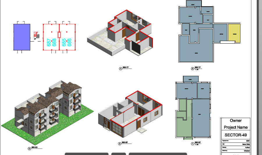
| Step 9 | Create Building Models in Revit for Building Permits submitted to Municipality | Generate BIM Data for Urban Buildings from 2018 |
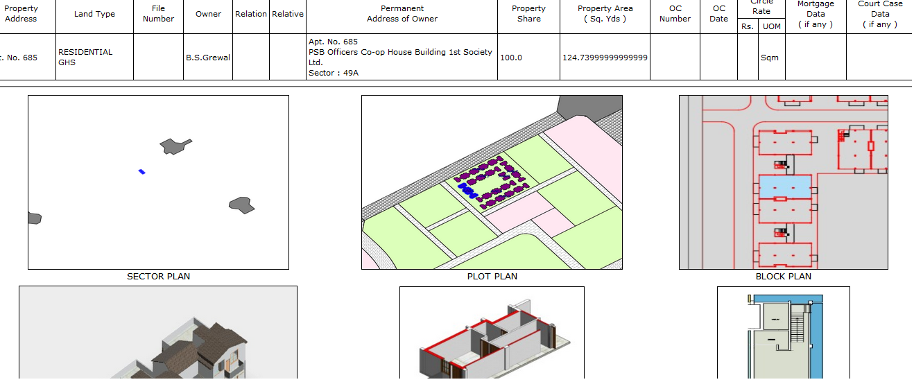
| Step 10 | View and Display of Title Documents with Title Sketches and 3D Building Models | Citizens can search, view and download Title Data from single source |
| Step 11 | Continuous Update of Title Sketches | Tehsildars to conduct Field Survey using Total Stations and updated Title Sketches whenever there is a Parcel Split or Amalgamation on change of Title |
ARCHITECTURE: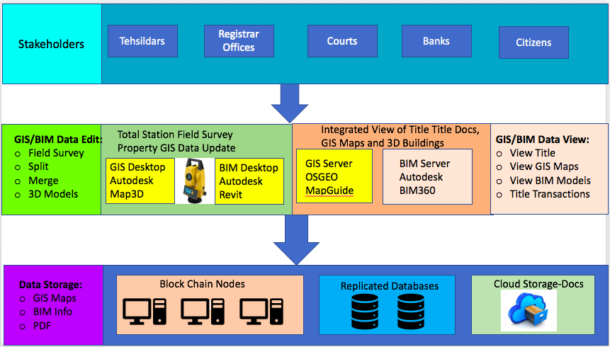
|
COMPONENTS OF Land Title System:
|
BENEFITS:
|
ROAD AHEAD:Regency InfoTech would like to incorporate the following as Phase II of Land Title System:
|